27 July 1892: The Rev Lower Carter leads members of Leeds Geological Association from Hyde Park Corner on a tour of Rowley and Co’s quarries in Meanwood Valley
William Lower Carter. 1885. July 27th, 1892. Excursion to the Meanwood Valley. Leader, Mr. W.L. Carter, M.A., F.G.S. Transactions of the Leeds Geological Association Containing Abstracts of Papers Read and Reports of Field Excursions, during Sessions 1883-4-5, Vol. 1. Ed. Samuel A. Adamson. Leeds: Leeds Geological Association. Get it:
.Unedited excerpt
If an excerpt is used in the book, it will be shorter, edited and, where applicable, translated.
JULY 27TH, 1892.
EXCURSION TO THE MEANWOOD VALLEY.
Leader, Mr. W. L. CARTER, M.A., F.G.S.
The members of the Leeds Geological Association on Wednesday evening, July 27th, met at Hyde Park Corner, under the leadership of Mr. W. L. Carter, M.A., for an inspection of the quarries in the Meanwood Valley. When the party reached the Ridge a short halt was made whilst the leader pointed out the general geological features of the far-stretching landscape. All the country within view was composed of Carboniferous rocks. A fault, which has been traced for a distance of ten miles, starts west of Weetwood, and passes through Meanwood in an easterly direction to Bramham Moor, bringing down the Lower Coal Measures on its southern side to the level of the middle grits of the Millstone Grit series.
The Meanwood Beck, which rises on Adel Moor, after cutting for itself a picturesque gorge in the hard Millstone Grit beds, crosses this fault at Weetwood, and then flows in a wider valley through the softer grits and shales of the Coal Measure series. The ridges on either side of the Meanwood Valley are capped by the Elland flagstones, which lie fairly horizontal. Below this capping lie beds of shale and friable sandstone about 160 feet thick, and at the bottom of the valley the ganister beds proper are found.
The party then descended the Ridge by Batty Wood to visit the quarries of Messrs. B. Rowley and Co. There are two ganister quarries worked in the valley, which are separated by a fault, the effect of which in the uplifting of the southern beds was very clearly seen some years back. The southern quarry, as the one which is at present being worked, was then examined, and an account of the beds was given by the leader. The whole section seen is about 36 feet in depth. Under 18 inches of surface soil there comes a thickness of 7 feet of stiff yellow clay, which encloses lenticular pockets of sand at intervals, and is full of angular and subangular pieces of ganister stone. Occasionally a boulder of coarse grit is found, well rounded and decomposed, probably derived from one of the grits of the Millstone Grit series. No foreign rock, excepting one small piece of chert, has been found in this clay, which has been generally considered as the ground moraine of a glacier which moved into the valley from the direction of Moortown. Under this deposit come the Lower Coal Measures or Ganister beds, which are pretty constant in thickness in the sections exposed from time to time. About 5 feet of yellow or brown shales overlie 2 feet 6 inches of black shale. These beds are unfossiliferous, and are frequently found contorted in a remarkable manner. The lower black shales are ridged up into folds wherever there is a hollow in the surface of the underlying ganister. Above these sharp ridges the yellow shales are bent in like manner, and often form a series of crumplings, the axes of which run in an easterly and westerly direction, and may be glacial in their origin. Underneath the shales come the ganister beds proper, which are well developed in this district. The uppermost bed is a hard, bluish-white, siliceous rock, false bedded, and containing few stigmaria (the roots of sigillaria). This bed is about three feet in thickness, and overlies ten feet of white and grey ganister, which shows much current-bedding, and is traversed by well preserved stigmaria, with whorls of leaf-like rootlets surrounding the central root, and forming at the point of their attachment the round pits which are so characteristic of these fossils. In this division many stumps of sigillarian trees have been found, with great roots stretching in all directions. Eleven have been unearthed during the last year’s quarrying at various levels. The largest one has, fortunately, been well revealed by a shot, instead of destroyed as is usually the case. It stands about the middle of the solid ganister rock, twenty-four feet from the surface. It is four feet in height, and eleven feet in circumference. The trunk is only marked by broad longitudinal flutings; but the large roots, four of which have been exposed to view, have the usual pittings which are characteristic of stigmaria. The largest root was blown off by the shot which revealed the tree, but its course can be traced by the impression it has left on the rock beneath. This cast shows that the first bifurcation took place about 1ft. 9in. from the junction with the trunk on the under-side, but 9in. farther away at the outer edge. This is shown by a very definite cast of the outline of the root, giving a central ridge about 9in. long, with grooves passing off from it to the right and left. The northerly branch appears to have crossed over the next root, and has left an impression on its surface. The other large root, which is well preserved and exposed, bifurcates for the first time about 2ft. from the trunk, on the upper side, and the two branch roots stretch out along the plane of bedding. The second bifurcation of one of them is seen, and takes place 4ft. 6in. from the trunk. Another root is partially exposed on each side. the bottom of these beds of grey ganister there comes a black bed, which is full of stigmaria, calamites, and other plant remains. Under this comes a seam of coal, about 9in. in thickness, which maintains an even thickness over an undulating surface of underlying fire-clay. This coal seam is frequently traversed by stigmaria which form ribs, as it were, of sandstone, running through the coal. This coal is considered to be the equivalent, in the district, of the Hard Bed Band (48 yards) Coal, which is much more fully developed in the south-west of Yorkshire. Underneath the coal seam come the fire-clay beds, which consist of 1ft. 6in, of hard black ganister, and 3ft. 6in. of softer fire-clay. In these beds two or three trees have been found, and they are traversed in all directions by stigmaria. The whole series is underlaid by a considerable thickness of black shales, which are not worked.
After this quarry had been thoroughly inspected, and specimens obtained, the party took a walk through the pretty village of Meanwood to Mr. Bradley’s quarries in Meanwood Wood, where the Third Grits of the Millstone Grit series are worked for building stone. The shades of evening, however, prevented more than a casual examination of these beds, but before the party set off on their return journey hearty votes of thanks were accorded to Mr. Rowley and Mr. Bradley for their kind permission to inspect their interesting quarries.
NOTE: Since the date of the above excursion excavations have been continued in the ganister quarries belonging to Messrs. B. Rowley and Co., and the foldings mentioned above have been traced further. A fault runs between the two quarries but the folds did not appear to have any relation to it at the time of the above examination. These crumplings were then attributed to the movement of a tongue of glacier-ice from the direction of Moortown, which it was supposed had ground away the outcrop of the ganister beds in that direction and left the surface bed of stony clay when it melted. During the summer of 1893. however, other rapid flexures of the shales were found which were, in this case, clearly attributable to the movement of a small fault along a joint face, and parallel to the main fault which comes a few yards to the southward. No faulting has been yet proved along the line of the fold described in the above excursion, but until further evidence is forthcoming the theory of the glacial origin of the fold and the stony clay must be held in abeyance.-W.L.C.
Comment
Comment
Something to say? Get in touch
Tags
Tags are assigned inclusively on the basis of an entry’s original text and any comment. You may find this confusing if you only read an entry excerpt.
- Adel (1) W/G ·
- 📌Batty’s Wood (1) W/G ·
- 📌Bramham Moor (2), scene in 1408 of the final battle of the Percy Rebellion against Henry IV W/G ·
- Carboniferous (1), geologic period and system of the Paleozoic era spaning 60 million years, from the end of the Devonian Period 358.86 Ma to the beginning of the Permian Period, 298.9 Ma; carboniferous means "coal-bearing" and refers to the many coal beds formed globally during that time W/G ·
- Chert (1) W/G ·
- Clay (4) W/G ·
- Coal measures (3), coal-bearing part of the Upper Carboniferous System, here generally underlain by Millstone Grit, W/G ·
- Coal (18) W/G ·
- Fault (geology) (1) W/G ·
- Flagstone (3) W/G ·
- Ganister (1), A close-grained siliceous stone (also described as "a mixture of ground quartz and fire-clay") from the lower coal-measures in Yorkshire, ground down to form furnace-hearths, etc. W/G ·
- Geology (4) W/G ·
- Glacier (2) W/G ·
- Gritstone (1) W/G ·
- 📌Headingley (15) W/G ·
- Holocene (1) W/G ·
- Ice age (1) W/G ·
- Last Glacial Period (1) W/G ·
- 📌Leeds (249) W/G ·
- Meanwood Valley (1) W/G ·
- 📌Meanwood (10), suburb and former village in north-west Leeds W/G ·
- Millstone Grit (4), coarse-grained Carboniferous sandstones, once frequently used for millstones in watermills W/G ·
- Moortown, Leeds (1) W/G ·
- Paleozoic (1) W/G ·
- Pleistocene (1) W/G ·
- Quarry (5) W/G ·
- Sandstone (2), clastic sedimentary rock composed mainly of sand-sized silicate grains, cemented together by another mineral; comprises 20–25% of all sedimentary rocks; most sandstone is composed of quartz or feldspar, because they are the most resistant minerals to the weathering processes at the Earth's surface; may be imparted any color by impurities within the minerals; formations usually allow the percolation of water and other fluids and are porous enough to store large quantities, making them valuable aquifers and petroleum reservoirs W/G ·
- Sedimentary rock (1) W/G ·
- Shale (2), fine-grained, clastic sedimentary rock formed from mud that is a mix of flakes of clay minerals and tiny fragments of other minerals, especially quartz and calcite; characterised by its tendency to split into thin layers less than one centimeter thick; term sometimes applied more broadly, as a synonym for mudrock W/G ·
- Sigillaria (1), genus of extinct, spore-bearing, arborescent lycophyte, known from the Carboniferous and Permian periods, related to the more famous Lepidodendron, and more distantly to modern quillworts W/G ·
- Stigmaria (1), common fossils found in Carboniferous rocks, representing the underground rooting structures of arborescent lycophytes such as Sigillaria and Lepidodendron W/G ·
- Weetwood (3) W/G ·
- Woodhouse Ridge (3) W/G ·
Comment
Comment
Something to say? Get in touch
Similar
 30 May 1835: Alfred Austin, future poet laureate, “Banjo-Byron that twangs the strum-strum,” is born into rural splendour at Ashwood, 48 Headingley Lane, Leeds
 Reproduction through the blind benevolence of Leeds Other Paper (RIP).1 April 1979: Amid motorway mania in Leeds, West Yorkshire Council is today to reveal plans to link Chapeltown and Woodhouse by a ¼-mile suspension bridge across Meanwood Beck
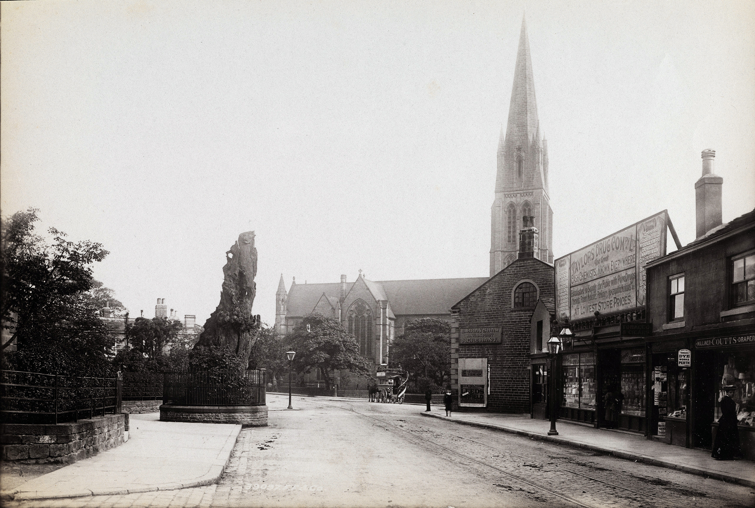 26 May 1941: Headingley’s Shire Oak falls, legendary site of Anglo-Saxon local government between Aire and Wharfe
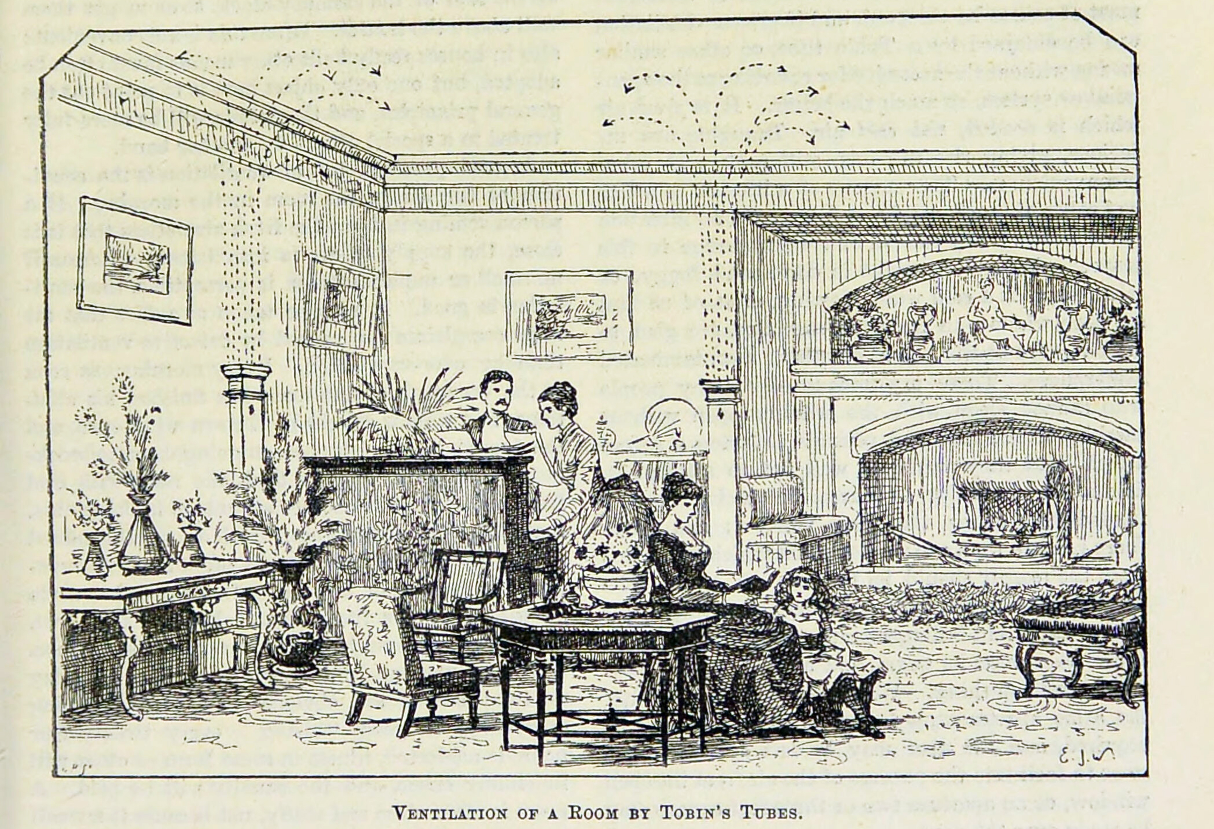
Comment
Comment
The Commissioners of Patents’ Journal records the seal on 1873/09/16 for:
1081 MARTIN TOBIN, of Leeds, in the county of York, Gentleman, for an invention of “An improved means or mode of ventilating rooms or apartments and in the apparatus employed therefor.” Dated 24th March, 1873. (Patent Office 1873/09/16)
I can’t find the volume for the first half of 1873.
John Whitehurst came to similar conclusions in the late 18th century (Whitehurst 1794).
I am sure that the devil was in the detail, but how good were Tobin’s Tubes really?
The Tobin tube (a vertical shaft, open at the top, and communicating with the outside at the base) was popular in Victorian times (c 1878). One such had a water trough at the base of the shaft, ostensibly to trap dust from the incoming air. The Tobin tube was not a success and, shortly after its introduction, Edwards stated flatly that either the free area was too small or the incoming air immediately spilled over the top onto the floor. Worse, the provision of lids meant that all too often they were permanently closed. Yet the Tobin tube remained in use for 30 years or more, and was even recommended by an early 20th century architect.
[…]
In 1894, Professor Jacob, a pathologist, held the architect in contempt:
In most cases architects are content to introduce an occasional air brick or a patented device called a “ventilator” … Real ventilation is so uncommon that the architect usually thinks this object has been attained if some of the windows can be opened. Some think that the presence of “ventilators”, especially if they have long names and are secured by Her Majesty’s letters patent, ensures the required end. We may as well supply our house with water by making the trap door in the roof to admit rain.
Something to say? Get in touch
Search
Subscribe/buy
Donate
Music & books
Place-People-Play: Childcare (and the Kazookestra) on the Headingley/Weetwood borders next to Meanwood Park.
Music from and about Yorkshire by Leeds's Singing Organ-Grinder.