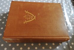
War Office: Belgium: Valenciennes 12, Edition 2 (1916)

£10.50

Ordnance Survey. Paperback. Folding cloth-backed 1:100,000 British Army map. Geographical Section, General Staff No. 2364. Ordnance Survey 1916. Settlements include Douai, Cambrai, Valenciennes, Mons. Google John Cruickshank, “Small scale maps of the Western front” for an excellent overview of British Army/Ordnance Survey mapping during the First World War.

Condition: Used – Very Good. Mild discolouration, fading, fraying of covers, small cigarette burn through cover and map, several peripheral discolourations on map. ISBN: none. Box MC13

In stock

Description

From the library of the archaeologist Arthur ApSimon (1927-2019). Reminiscences and obituaries in Salon (Society of Antiquaries), Mike Pitts’ Digging Deeper, Proceedings of the University of Bristol Spelæological Society, Cornish Archaeology (paywall).

The circa 500 books to be sold will be listed here gradually, and additional photos and details may appear. Updates may be posted on the blog (subscribe to the RSS feed or the mailing list in the right-hand column) and, more probably, on Twitter. Ask Trevor stuff here.


A watercolour of Stonehenge by the young Arthur ApSimon.